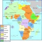
Italy was one of the European countries with colonies in Africa during the modern period. Lasting from 1890 to 1941, Italian colonialism in Africa included the presentday countries of Libya, Ethiopia, Eritrea, and Somalia
Culture religion
Italian colonialism was also not guided by religious motives of converting native populations to Christianity. Italian imperialism was later shaped by Fascist doctrines of governance and social policy, which affected methods of administration and treatment of the indigenous African population.
Prince Luigi Amedeo founded the Società Agricola Italo-Somala (SAIS) in 1920 , to explore the agricultural potential of Africa, he could take advantage of that agricultural resources and take them to Italy.
Grography
Somalia, situated in the Horn of Africa, lies along the Gulf of Aden and the Indian Ocean. It is bounded by Djibouti in the northwest, Ethiopia in the west, and Kenya in the southwest. In area it is slightly smaller than Texas. Generally arid and barren, Somalia has two chief rivers, the Shebelle and the Juba

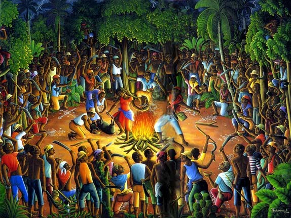
CulturalSomali culture is largely based on Islam and poetry, and has developed over the years orally. The ease in speech is considered a special property among Somalis, taking into account figures such as politicians or religious leaders.The religious majority in the country is Sunni, forcing citizens to refrain from consuming pork and alcohol, and to participate in games of chance. Many women wear the hijab.The prevailing religion in Somalia has changed throughout its history. Each nation or empire that has conquered the country, has tried to impose their religion and with it a set of traditions and beliefs. What did the British, who attempted to impose Protestantism. The Italians tried to fascism, but not made greater efforts to impose religiously.Currently, the predominant religion in Somalia is Islam, with few exceptions. They practice Sunni Muslims. This fact reinforces the idea that the country is distancing itself from the rest of Africa and its neighbors, practice Christianity and native religions. Somalia's constitution also defines Islam as the official religion of the Republic of Somalia.The Islamic ideal is a society organized to implement Muslim precepts in which there is no distinction between secular and religious spheres. Among Somalis this ideal has been achieved less in the north than among some groups settled in the southern regions where religious leaders are an important part of the political and social structure. Among the nomads, the exigencies of life of the pastor gave greater weight to the role of the warrior, and religious leaders expected to stay out of political issues.The role of religious functionaries began to decline in the 1950 and 1960 as part of their legal and educational powers and responsibilities were transferred to the secular authorities. The position of religious leaders changed substantially after the 1969 revolution and the introduction of scientific socialism. Siad Barre insisted that his version of socialism is compatible with the principles of the Koran, and condemned atheism. Religious leaders, however, were warned not to meddle in politics.
Manufact
The latter include fish-canning and meat-processing plants in the north, as well as about 25 factories in the Mogadishu area, which manufacture pasta, mineral water, confections, plastic bags, fabric, hides and skins, detergent and soap, aluminum, foam mattresses and pillows, fishing boats, carry out packaging, and stone processing.[10]
Natural resources
The natural resources of the country can be generally divided into 1) Marine resources (fish and salt) 2) surface resources (e.g., forests, wild life, frankincense and Myrrh, surface water, etc),
These natural resources include primary row materials for various kinds of industry, e.g, cement industry, industry for prefabricated walls, roofing, floor and wall tiles, aggregates and concrete production, and industrial minerals. Minerals with high potential include gold, zinc, lead, manganese, aluminum, and graphite
Only 1.6% of Somalia's total land area is cultivated, and 69% is permanent pasture. There are two main types of agriculture, one indigenous and the other introduced by European settlers.
Corn, sorghum, beans, rice, vegetables, cotton, and sesame are grown by both methods. Somali and Italian farmers operating the banana farms practice more modern European-style techniques, as do some of the newly created Somali cooperatives. A system of state-administered farms grew rapidly during the early 1970s.
ERITREA
Eritrea is located in the Horn of Africa and is bordered on the northeast and east by the Red Sea, on the west and northwest by Sudan, on the south by Ethiopia, and on the southeast by Djibouti

Natural resources
Eritrea has metal resources, which include gold, zinc and copper. Other natural resources for the country include salt, potash, fish, and a possibility of oil and natural gas.
Agriculture
Eritrea has 565,000 hectares (1,396,000 acres) of arable land and permanent crops. Three-quarters of Eritrea’s people are subsistence farmers dependent on unreliable rainfall to feed families that average seven children. Although these farmers have experienced relative peace and good harvests since May 1991, food production has not been able to keep pace with a rapidly expanding population. Harvests have been variable due to rainfall variations and pest infestations. The present government dissolved the former Ethiopian military regime’s marketing board and reinstituted private markets for agricultural products.
Principal crops in 2004 included sorghum, 56,700 tons; millet, 11,600 tons; barley, 16,900 tons; and wheat, 17,200 tons. Legumes, vegetables, fruits, sesame, and linseed are also grown.
War, drought, deforestation, and erosion caused about 70–80% of the population to become dependent on food aid. Agricultural output, however, increased slightly during the 1990s, due to the ending of the war, favorable weather, and a newly developed seed and fertilizer distribution system. The army is involved in agricultural restoration, evidence of the government’s commitment to agricultural reform.
Cultura
The culture of Eritrea has been largely shaped by its location on the Red Sea coast, as well as the area's historic links with Ethiopia, Somalia, Djibouti, Sudan, the Near East and Italy. The local culture consists of various, and often quite similar, traditions practiced by the nation's many Cushitic and Semitic-speaking Afro-Asiatic ethnic groups, in addition to those practiced by the area's Nilotic minorities. Eritrea's semi-arid terrain in the northeastern Sahel and its unique climate have also been important influences on local customs.
Manu
The manufacturing industry is unable to meet domestic needs, while its exports are insignificant. Exports earned a paltry $4 million in 1998, while imports of industrial goods ran to $250 million. Manufacturing consists of Asmara-based small and medium size establishments producing consumer products such as glass, leather, processed foods, cotton, textile, liquors, and other beverages. New factories produce marble, recycled plastics, metals, and rubber goods. Low investment and management capacity, outdated machinery, and poor infrastructure have prevented growth, and the Eritrean government has privatized some of its industries while ending subsidies to others to stimulate development. It has also lowered taxes and tariffs on industrial exports and imports and offered other incentives to foreign investors.
LYBIA
GEOG Libya is fourth in size among the countries of Africa and seventeenth among the countries of the world. Its coastline lies between Egypt and Tunisia. Although the oil discoveries of the 1960s have brought it immense petroleum wealth, at the time of its independence it was an extremely poor desert state whose only important physical asset appeared to be its strategic location at the midpoint of Africa's northern rim. It lay within easy reach of the major European nations and linked the Arab countries of North Africa with those of the Middle East, facts that throughout history had made its urban centers bustling crossroads rather than isolated backwaters without external social influences. Consequently, an immense social gap developed between the cities, cosmopolitan and peopled largely by foreigners, and the desert hinterland, where tribal chieftains ruled in isolation and where social change was minimal.
RAPY
Culture
As Arabs the vast majority of Libyans are Muslim. Colonel Qaddafi states that Islam is the only viable system that can help answer man's political, economic and social problems on earth and provide him with happiness in the world to come. In November 1973, a new code of law appeared emphasizing Sharia law in all facets of the Libyan legal system. After the Revolution in September 1969 and in compliance with Islamic law, alcoholic beverages were outlawed. Bars and nightclubs were closed, and modest and provocative entertainment was banned. The use of the Islamic Hijri calendar was also made mandatory.
For more information about Islam click > An Introduction to Islam
Family Life
Until fairly recently the extended family was the norm. Today it is increasingly common for young couples to set up home on their own. This is especially true of Tripoli.
It is important for Libyans to maintain the dignity, honour and a good reputation of their families through their own conduct. This is a collective culture. In order to maintain a sense of harmony, people will act with decorum at all times and not do not do anything to cause someone else public embarrassment. Personal feelings and needs are often subjugated for the good of the group.
Agriculture
Although agriculture is the second-largest sector in the economy, Libya depends on imports in most foods. Climatic conditions and poor soils limit farm output, and domestic food production meets about 25% of demand. Domestic conditions limit output, while income and population growth have increased food consumption. Because of low rainfall, agricultural projects like the Kufra Oasis rely on underground water sources. Libya's primary agricultural water source remains the Great Manmade River (GMMR), but significant resources are being invested in desalinization research to meet growing demand. Libyan agricultural projects and policies are overseen by a General Inspector; there is no Ministry of Agriculture, per se.
Natural resources
Natural resources: petroleum, natural gas, gypsum
Definition: This entry lists a country's mineral, petroleum, hydropower, and other resources of commercial importance.
Manufactured
Industrial development is limited, although it expanded during the United Nations (UN) embargo of the country in the 1990s. Most factories are located in Tripoli and Banghāzī and are managed by Arabs. The industrial workforce is small, with many factories employing fewer than 100 people. A majority of the factories manufacture processed food, cement, and textiles. The government maintains monopolies for processing of tobacco, salt, and esparto grass. There are also oil-related industries, which produce steel drums, tanks, and pipe fittings; petrochemical plants are located near refineries. ... (90 of 11687 words)